
THE LANDSCAPES OF PRE-INDUSTRIAL CITIES (PART 1 AND 2)

John Beardsley, director of garden and landscape studies at Dumbarton Oaks, opened the Landscapes of Pre-Industrial Cities symposium in Washington, D.C. with a promise that the invited speakers would explore “the origins and future trajectories of urban landscapes” — shedding light, through case studies spanning millennia, on the complex evolutions and experiences of urban settlements over time.
Two days later, after 13 scholars of archaeology, art, and anthropology had presented their work, Beardsley, asked: “When we look back at these pre-industrial cities, are we seeing what we want to see? I’ve heard a lot about flexibility, resilience, multiplicity, diversity, ecological socialism, self-organization — these are all very contemporary values and things that we want to see in our cities now.” Beardsley posed: “Are we projecting these values back in a mistaken way, or are we excavating earlier adaptations that provide useful lessons for us?”
Tim Murtha, a professor at Pennsylvania State University, offered a response: “I think the answer is both. And that’s the hardest thing for an archaeologist to say, but I’m okay saying it because I teach in a landscape architecture department.”
Murtha continued: “What if that’s not a problem? What if that allows us to start thinking about present cities and future cities and exposing those values as part of our archaeological imagination?”
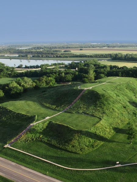
Murtha’s work in the ancient Mayan lowlands has challenged the archaeological imagination of his predecessors, who largely focused on the structural and engineering feats of population centers and treated regional landscapes as peripheral and less significant. Murtha has used LiDAR, a remote sensing technology, and climate and hydrologic modeling to explore regional landscapes from eastern Veracruz to the northern tip of Yucatan (see image above).
He found evidence of intricate and highly-varied patterns of terraces, reservoirs, and field boundaries, seemingly formed in response to their geological surroundings and without reference or connection to the nearest city.
“Households dominated these landscapes in a regionally-expressive mosaic,” Murtha said, suggesting that archaeologists and planners “need to concentrate less on the potential exceptionalism of our places and density-dependent analysis, and pay more attention to the regional narratives of landscapes and households as expressions of coupled human and natural systems.”
Archaeologists are also using LiDAR in Cambodia to enrich our understanding of an ancient landscape that today is dominated by temple architecture. J. B. Chevance, with the Archaeology and Development Foundation’s Phnom Kulen Program in Cambodia, and Christophe Pottier, Ecole francaise d’Extreme-Orient in Paris, said remote sensing technology coupled with field work has allowed archaeologists to situate the spectacular historic temples of Angkor within a similarly spectacular historic landscape, which over hundreds of years saw deforestation, diversion of rivers, and the construction of hydraulic channels and agricultural fields to serve shifting human settlements.
Chevance’s work focuses on Phnom Kulen, the birthplace and early capital of the Khmer empire, located close to the Angkor World Heritage Site but largely unexplored. Chevance said that for years the archaeological approach to the Khmer empire considered only the remains of monumental architecture, sculpture, and inscriptions. “Studies were therefore mostly oriented toward the elites, religious architecture and religion, whereas the common life and the territorial approach were not relayed.”

Pottier said the emergence of LiDAR technology in the mid-1990s allowed archaeologists to see beyond the narrative of Angkor urbanism as “a story of boxes and squares,” a narrative that he said was developed largely by architects taken by the geometries of Angkor’s monumental remains.
Pottier instead traced the more recent LiDAR-enabled discoveries of regional networks of roads, canals, rice fields, and small-scale ponds and temples that defined the forms of dispersed population centers, which themselves shifted over hundreds of years, often rebuilding in a way that incorporated sites that had been abandoned but were formerly significant. He contrasted this new understanding of a complex human landscape with the popular vision of Angkor as a city of temples amid a green jungle.
“These are two completely different versions of urbanism and territorial development,” Pottier said. “The vision of Angkor itself is only a matter of how you map it.”
Georges Farhat, a symposium organizer from the University of Toronto, also addressed the role of representation, along with the potential pitfalls of examining ancient cities through a modern Western lens.
“We heard over the course of these two days issues of representation suggesting that what we see defines what we think, and what we are able to visualize will determine what we will be able to understand,” Farhat said. “We also heard about the importance of excavating patterns the way you excavate fossils — it determines what you conclude or draw from the field.”
Timothy Pauketat, a professor at the University of Illinois Urbana-Champaign, said that in his work to understand Cahokia, a pre-historic Native American city in present-day Illinois, he attempts to align his “scientific Western approach” with a sensory one, imagining how the experience of the swampy site along the Mississippi River might have inspired the people who built the waterways, residential neighborhoods, and monumental precincts that defined Cahokian urbanism.
Early archaeologists at Cahokia assumed the site was never inhabited by humans, Pauketat said, because of their own inability to imagine that people might select to live among what Charles Dickens described, when he passed through Cahokia’s eroding earthen monuments on an American tour, as “a swamp, the bush, the perpetual chorus of frogs, the rank unseemly growth and the unwholesome steaming earth.”
Pauketat offered: “But what if the auditory affects of the frogs that bedeviled Dickens were positive, entangled with the experiential aspects of a place of fertile soil, life-giving rains, and sweet flavors of an exotic and water-sensitive plant? That it’s quite possibly the pre-urban landscape of this region, with embodied spiritual energies of water and weather and fertility, that might attract people?”
Michael Heckenberger, a professor at University of Florida who studies the experiential aspects of past and present Amazonian building and planning practices, has worked with the indigenous Kuikuro community in the Upper Xingu region of Brazil to uncover pre-Columbian roads that connected a dense network of towns and villages nestled within the Amazon. Heckenberger said that from the scale of the house to the scale of the region, the design of places was in relation and proportion to the human form and physical context, in what he called “a corporeal and relational calculus.”
In describing his ongoing partnership with the Kuikuro, Heckenberger advocated more broadly for dialogue with peoples and places that can offer lessons about the design of settlements that serve human and ecological health.
Priyaleen Singh, at the School of Planning and Architecture in New Delhi, advocated the same in her case studies on the disparate development trajectories of Old and New Bhubaneswar in India. Old Bhubaneswar was built from the sixth to ninth centuries C.E. as a pilgrimage center, with distinctive temple architecture, a network of pools, or tanks, and a wealth of open spaces integrated into the urban fabric in the form of courtyards and shade-giving groves. New Bhubaneswar, planned by Otto Koenigsberger in the 1950s, adhered to Western planning practices of the time, separating districts by use and, Singh argues, eschewing the human scale.
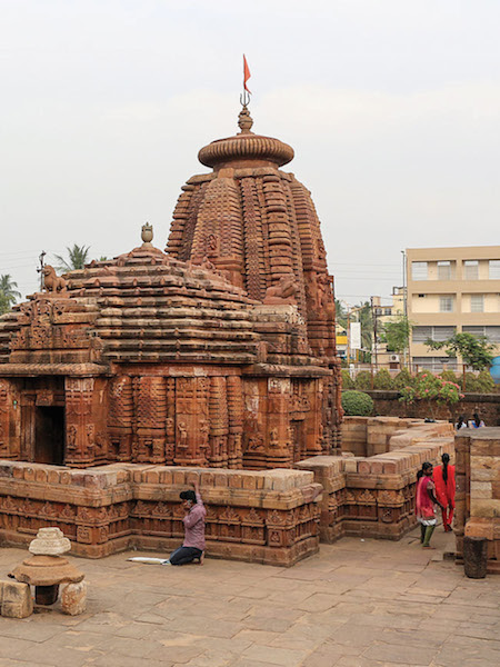
“Natural ecology and cultural ecology were overtly interwoven and expressed in design forms and other cultural expressions of the open spaces in Old Bhubaneswar,” Singh said. “Temple tanks and groves — besides constituting the genius of the place and giving meaning to the landscape — also ensured that nature was both respected and integrated with the everyday life and experience of the people. Traditional design vocabularies encouraged a participatory relationship with nature, encouraging an experiential aesthetics as opposed to a purely visual one.”
Singh pointed in contrast to mono-functional green spaces, slick nature-themed marketing, and the growing dominance of non-native plant species within New Bhubaneswar development. “In New Bhubaneswar, nature and its elements have been reduced to a mere beautification exercise, and image-making has overshadowed the more real ecological demands.”
This guest post is by Lindsey Naylor, Student ASLA, master’s of landscape architecture candidate, North Carolina State University.
The Landscapes of Pre-Industrial Cities (Part 2)

Over two days, speakers at the Landscapes of Pre-Industrial Cities symposium at Dumbarton Oaks in Washington, D.C. grappled with questions like: How do cities evolve? Why do they form in the first place? To what extent are they shaped by their place, and to what extent by their inhabitants?
Monica Smith, University of California at Los Angeles, made a claim that continued to surface and provoke throughout the symposium: “Rural places do not need cities,” she said. “After all, dispersed rural settlement is the ancestral condition of our species. For a million years, our species was grouped into configurations no larger than the number of people in this room.”
Smith studies the history of human settlement in the “monsoon belt” of the Indian subcontinent, where sweltering-hot summers end with long deluges of rain. Smith is interested in how dramatic climates and abundant water affect the form and lived experience of cities and how they define the relationship between cities and their rural hinterlands.
She described “landscapes of provisioning,” in which urban cores draw food, resources, and labor from their rural surroundings, and in which a variety of rural settlements, including small towns and monasteries, continue the flow of resources to cities, even in times of catastrophic flood or earthquake.
Despite the risks in relying on such an arrangement, Smith said, “in the relatively short archaeological time period of about 6,000 years, we went from a world that had no cities, to a world that is full of cities, and there must have been something in our cognitive makeup that made that possible, necessary, and compelling.”
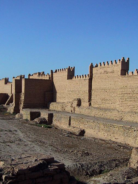
Many speakers outlined ancient processes of urbanization that were organic and self-organizing. A dramatic exception was J. Cameron Monroe, a professor at the University of California at Santa Cruz, who has been surveying urban settlement systems in tropical West Africa. He believes that 18th-century urban settlement and growth in Cana, a Dahomey city in present-day Benin, was the direct result of the Atlantic slave trade.
Monroe’s surveys and oral histories with local residents suggest that predatory slave raids depleted rural populations. As Cana emerged as a major player in the slave trade, other people migrated to the city in search of job opportunities created by the wealthy elite. The political, social, and economic dynamics of the slave trade “drove the process of urbanism itself.” (see image above).
Jason Ur, Harvard University, offered a different vision of urbanization, using the example of early Mesopotamian cities. He argued against previous archaeological theories that those cities, with their walls and geometric forms, must have been the result of top-down planning.
“These interpretations share the assumption that behind structured features, at the scale of the neighborhood or the entire city, one or a few powerful decision-makers must be lurking,” Ur said. “In some cases. these top-down processes are plausible. In most cases, however, such thinking limits agency to a subset of humanity and renders the rest as pliable non-actors.”
Ur instead suggested that Mesopotamian cities first emerged as informal settlements ringed by agricultural fields. Farmers and herders walked to the fields by the shortest paths possible without trampling crops. And as the population grew, settlement areas expanded into the closest possible farmland. Ur says these basic social and spatial principles established the earliest forms of roads and settlements, which were later formalized and walled-in as cities grew in size and sophistication.
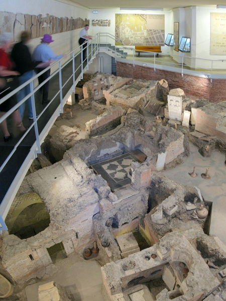
A term uttered often at the symposium was palimpsest, or something that has taken multiple shapes over time but still bears traces of its earlier form. It’s an apt term to describe urban landscapes and cities’ accumulated layers of history, culture, significance and meaning. Hendrick Dey, a professor at Hunter College City University of New York, shared stories of the physical layers that shed light on 12th-century planning and development in Rome.
Dey described a history in Rome characterized by population decline and recovery; multiple new cities emerging within the structures of the old; and earthquakes and maintenance decisions that saw the crumbling of monuments that once lined the Via Triumphalis, the route for Roman imperial processions. As that route transformed into a commercial center and as flooding and maintenance backlogs left it regularly in poor shape, Dey argues that church leaders of the 12th century made the decision to move the papal procession route just north to the Via Papalis — and to elevate the entire length of that road by three meters to protect it from flooding.
“How do you increase ground levels by three meters? Rome provides you with the greatest store of rubble that any ancient city could possibly have,” Dey said. “We have this complex interaction between the surviving bones of the Roman city, the natural environment, and the priorities of the human actors who are animating it as it becomes this densely developed settlement in the 12th century. None of it would have been possible without the fact of the largest field of ruins that exist anywhere in the western world.”
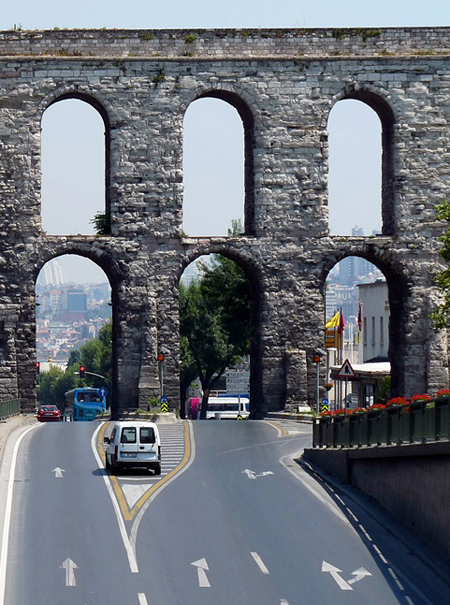
Jordan Pickett, University of Michigan, focused on the farthest reaches of the Roman empire from the first to eighth centuries where massive aqueducts were constructed to carry coveted spring water to even the most arid urban areas. Pickett traces the empire from the first century — defined by elite and monumental cities, and the power conveyed by conspicuous consumption and advanced engineering — to the Byzantine world centuries later, when aqueducts were most often abandoned as impractical or adapted to serve new industrial or agricultural uses, providing “a flexible framework from which a new set of alternatives for low-density, ruralized cities, fragmented and decentralized, could emerge.”
Pickett emphasized that Byzantine administrations had retained the capacity to maintain and repair the aqueduct network; what changed was the cultural and political approach to water. “This system was walked back, there was in fact a withdrawal,” Pickett said. “There was a decision to walk it back and to say this is a system that shouldn’t exist everywhere.”
The fluidity of city forms was apparent across the presentations and the places and times explored. Urban populations could change dramatically across wet and dry seasons. Past infrastructures could be put to new use or rendered obsolete. In Cahokia, the entire settlement of monuments, waterways, and neighborhoods might have been intended as a temporary religious installation.
Even in the study of walled cities in early West Africa, Suzanne Preston Blier, a professor of African art and history at Harvard, rejected the idea that walls denote a static or fixed order, particularly within an aesthetic culture that often intentionally rejected symmetry and rigidity. Blier called the West African city walls “lines of multiplexity” that demonstrated “the ability of one form, one way of engagement, one kind of plan, to carry multiple meanings, like a telegraph wire.” She said the walls were adaptable, built in reaction to their context, and used to order interior spaces and reflect shifting social patterns, rather than to define hard boundaries.
Attempts to define or reject urban boundaries animated discussions throughout the symposium. Alan Kolata, University of Chicago, proposed that we can have it both ways, recognizing the physical and cultural demarcations of cities and urban centers, in addition to the physical and cultural networks that render them part of their regional surroundings.
Kolata applies the concept of autopoiesis to his work uncovering the political and physical makeups of indigenous cities in the Americas. In its earliest biological definition, autopoiesis refers to the ability of a living cell to maintain and reproduce itself. Kolata draws from the term’s later use in systems and communications theories, in which the focus is on a system’s ability to maintain and reproduce its distinct identity, even as it is connected to and interacts with larger surrounding systems.
He uses autopoiesis as a metaphor that describes not only the importance of cities as complex social and ecological systems, but also as the settings for complex individual lives — “macro sociological features and processes of urban life with the micro sociological realities of lived human experience.” Kolata proposed this idea: “Cities are inherently autopoietic phenomena, deploying multiple social networks of communication to sustain the material requirements of life as well as to create a sense of urban identity — that is to say, a culture of place.”
This guest post is by Lindsey Naylor, Student ASLA, master’s of landscape architecture candidate, North Carolina State University.
Related Posts
Tags
Share This


Follow Us!